
Books about lightning barely mention the polar regions, and books about polar regions don’t mention lightning. There are societal impacts to the severe weather that often comes with lightning and with the forest fires that lightning can produce. In Antarctica, climate and weather dynamics are poorly understood, and lightning studies might help identify the preferential locations for convective precipitation. In the present study, lightning storms located 60° to 67° from the Equator are examined using simultaneous observation of lightning and ice-phase precipitation, both produced by storm updrafts. Hence, lightning is the “fire” and precipitation is the “ice.”
In December 2018, GMU researcher Owen Kelley and coauthors Jeremy Thomas, Natalia Solorzano, and Robert Holzworth (DigiPen Institute of Technology and University of Washington) presenting their finding about polar-region lightning at the American Geophysical Union’s annual conference. Their presentation is available as a PDF file.
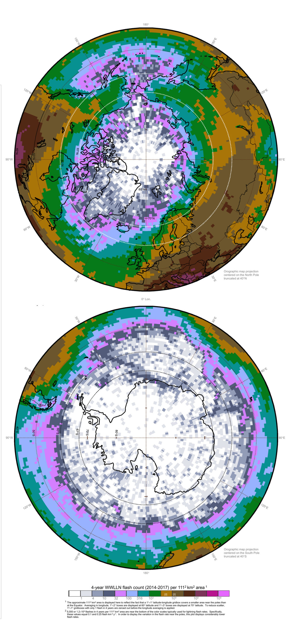
In thunderstorms 60°- 67° from the Equator, the lightning flash rate and the height that updrafts lift precipitation are seen to vary by hemisphere and by longitude. At these high latitudes, the observations appear consistent between the GPM Dual-frequency Precipitation Radar (DPR) and the World Wide Lightning Location Network (WWLLN). Individual lightning storms are observed to have lightning that is co-located with areas of high-altitude radar echoes. Four-year-total lightning flash counts and four-year-average radar-based precipitation characteristics show similar geographic variation.
Credits:
Kelley, O.A., J. N. Thomas, N. N. Solorzano, and R. Holzworth, 2018 Dec.: Fire and ice: Intense convective precipitation observed at high latitudes by the GPM satellite’s Dual-frequency Precipitation Radar (DPR) and the ground-based World Wide Lightning Location Network (WWLLN). poster presentation, H43F-2487, 2018 AGU annual meeting.
WWLLN data and antenna photograph provided by WWLLN / University of Washington.