
Two days before landfall, Laura had been forecasted to experience a period of weakening before landfall but instead, it ended up intensifying and deepening until its inner core was interacting with land. Consistent with NHC reports of continued intensifying is 3D evidence from the GPM satellite that Laura’s eyewall contained vigorous convection at 0300 UTC, 3 hours before landfall.
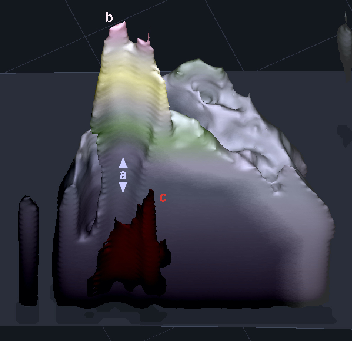
In this overflight, GPM’s Dual-frequency Precipitation Radar (DPR) saw a 15-km-tall hot tower in the eyewall. An nearby convective cell within the eyewall was shorter but contained an impressively strong 50-dBZ radar reflectivity signal in the mid-troposphere. Both observations are indicative of strong updrafts in the eyewall. In the image, a indicates the low-pressure center of the hurricane, also know as the eye because it is occasionally cloud free; b indicates the hot tower in the eyewall convection, and c indicates the region of extremely heavy precipitation in the eyewall.
A hot tower means that the eyewall’s updrafts were strong enough to lift small ice hydrometeors up and out of the troposphere, the layer of the atmosphere that usually contains storm systems. The 50 dBZ mid-troposphere signal means that updrafts were strong enough that ice particles where held aloft long enough to grow large, perhaps hail-sized, despite their fall speed increasing as they grew larger.